Late morning 14-miler with temperature hovering around freezing at the start of the run.

Pilgrim at Walnut Creek.
Late morning 14-miler with temperature hovering around freezing at the start of the run.
Pilgrim at Walnut Creek.
My son got sick and couldn’t run the Kid’s Dash, so I turned up for the 5K alone, stumbling over the finish line in 19:58 (9th/257) on a very scenic/diverse course.

First snowy run of the season (10 miles). Not really a proper snow, but snow nonetheless.

First snow.
![DSCN1816[1]](https://lukewilliamhunt.com/wp-content/uploads/2014/11/dscn181612.jpg)
The pond toward the southern end of Biscuit Run.
Light, 34-mile week to leisurely take in the leaves on local trails–primarily in Biscuit Run, which borders my neighborhood. Today’s second trip to BR included a 4.5-mile bike ride/hike with Henry, on which I had to carry his bike over only the most technical of spots.
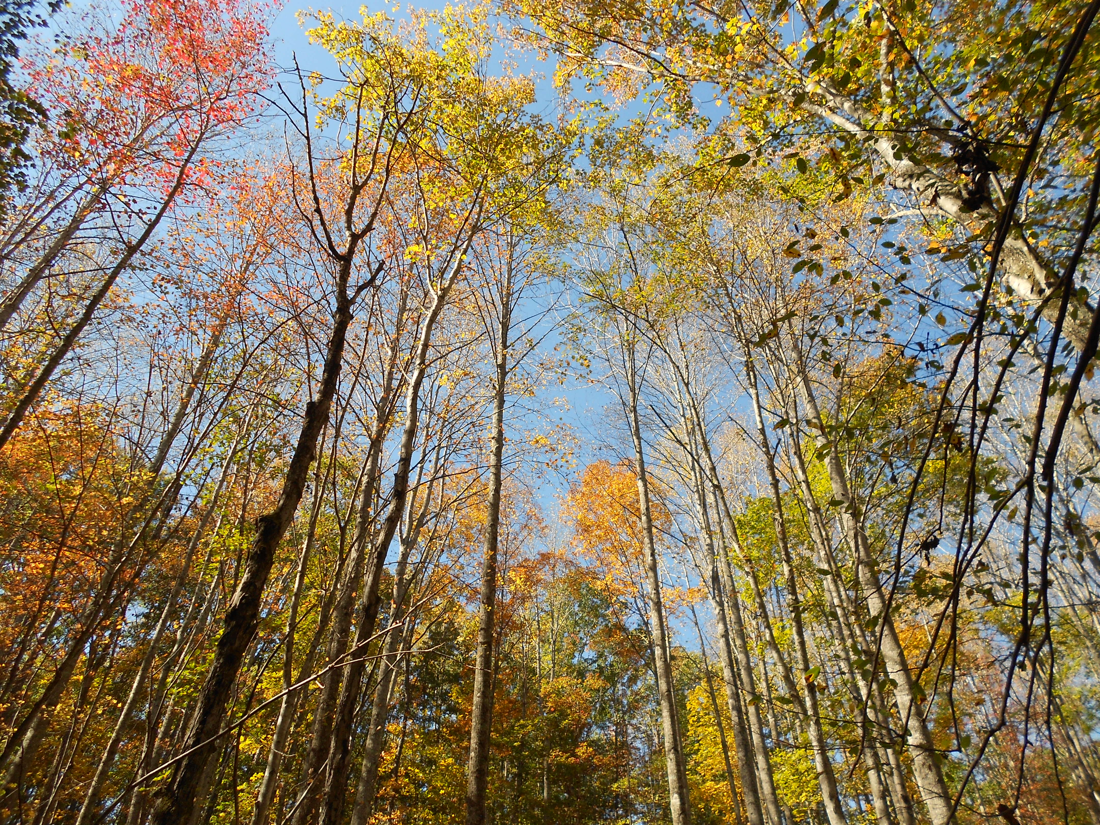
In Biscuit Run.

Front yard training session for Biscuit Run.
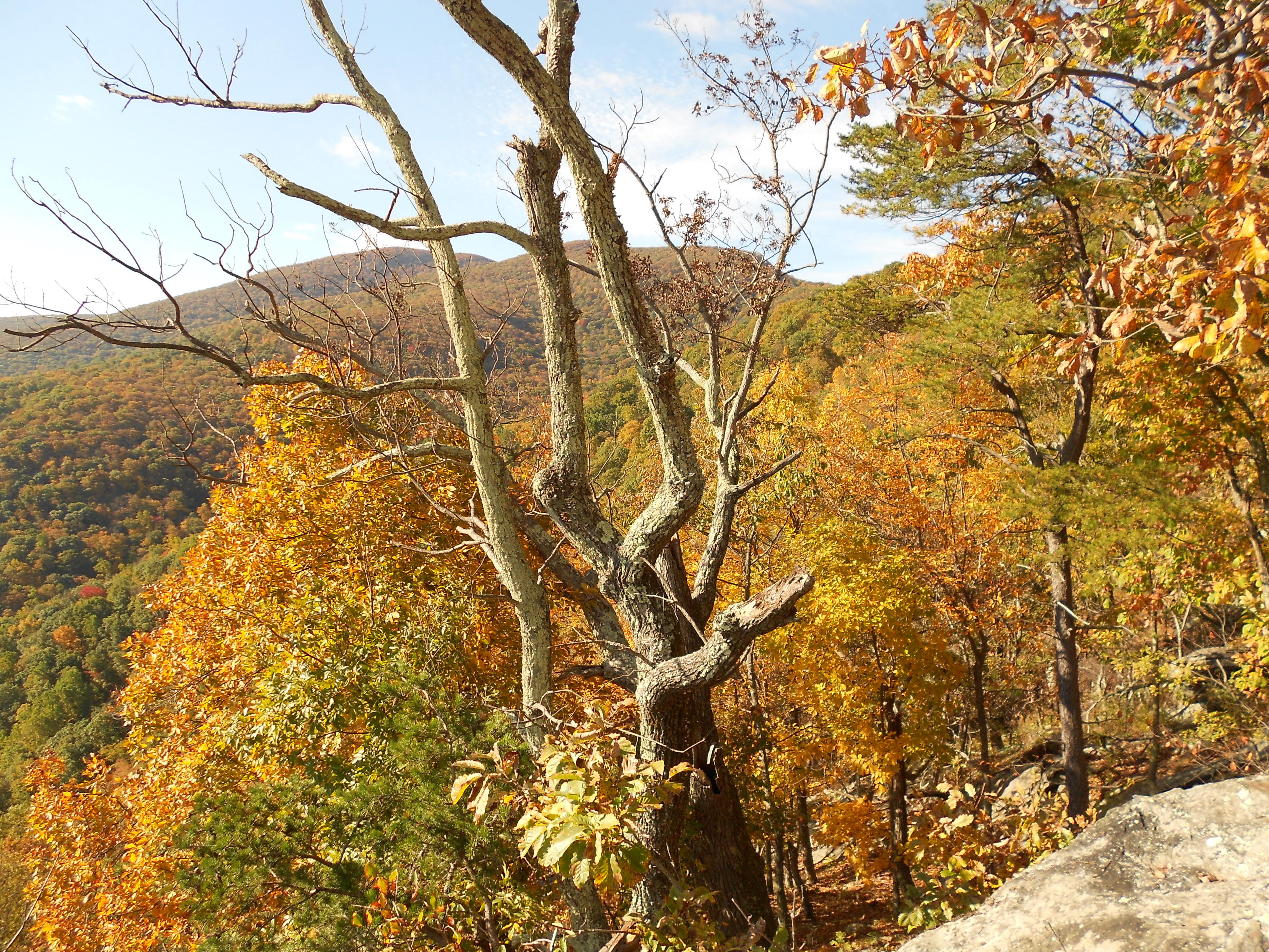
Stashed a thermos of water at Rockfish Gap and then drove south on the Blue Ridge Parkway to the Humpback Rocks parking area. Rather than head up the popular/crowded route to the rocks, I took the Old Howardsville Turnpike trail. This allowed me to quickly hit the Appalachian Trail north, make a brief stop at the Glass Hollow Overlook (the views aren’t quite as big as those at Humpback, but I had the place all to myself), and then finish the almost eight-mile run to Rockfish Gap to re-fill water bottles. Roughly the same route back, except that I took the blue-blazed Albright Loop Trail shortly after passing the Paul C. Wolf Shelter. There’s a bit of old plane wreckage just off the Albright trail. 16 miles total.

On the Old Howardsville Turnpike trail 48 seconds into my run. The leaves sort of stopped me in my tracks when I first got out there, and I had to force myself not to grab for my camera at every vista.

Glass Hollow Overlook.
Tree.
Crewed for Wesley in the Arkansas Traveller 100, which he won with a time of 15 hours, 59 minutes (third fastest time in the 24-year history of the race, and 22 minutes off the course record). I met him at five aid stations along the course (miles 16.1, 31.9, 48, 67.9, and 83.9; our Dad was at the last three), and we had him re-fueled and out of each station in less than two minutes, sometimes much less. At the last crew station (mile 83.9), I paced Wesley through the dark to the finish line. Really fun running through the pitch-black Ouachita National Forest with nothing but headlamps. My only concern was keeping up with Wesley during the last 16.1 miles; he ran mile 100 (mile 16 for me) in just under seven minutes.

Dad, Wesley, and I after the race on Saturday night.
Short drive to Powhatan on Saturday morning for the inaugural Belmead Trail Fest 50K. Very well-organized, friendly event on a fun course. I was able to hang on to men’s third place with the unremarkable time of 5 hours, 6 minutes–though it did get me a $30 gift certificate, which works out to almost $1 per mile.

I asked Melissa to take some cool pictures of the course, and I got this water tower.
Drove 4 miles or so from our hotel on Atlantic Avenue to 64th Street, where I parked outside one of the entrances to First Landing State Park. From there, took a right on the Cape Henry Trail and ran to the end and back; then ran the other side of the trail–toward Broad Bay–and back, for a total of 13 miles.
![DSCN1486[1]](https://lukewilliamhunt.com/wp-content/uploads/2014/09/dscn14861.jpg)
From hotel balcony.

Just off the Cape Henry Trail.
After spending Friday feeding wildebeest, etc., from our car, we made our way to The Inn at Gristmill Square in Warm Springs so I could run the Odyssey Trail Running Rampage marathon on Saturday morning. Here is the short version of a race report: I was doing well during the first half of the race. I then made two wrong turns (among other mistakes) and dropped. Still, it was a beautiful course and a lot of fun. (I covered a total of 19 miles, some of which was not on the course.)
Near the Gristmill Inn, between Warm Springs and Hot Springs on Hwy. 220 in Bath County.
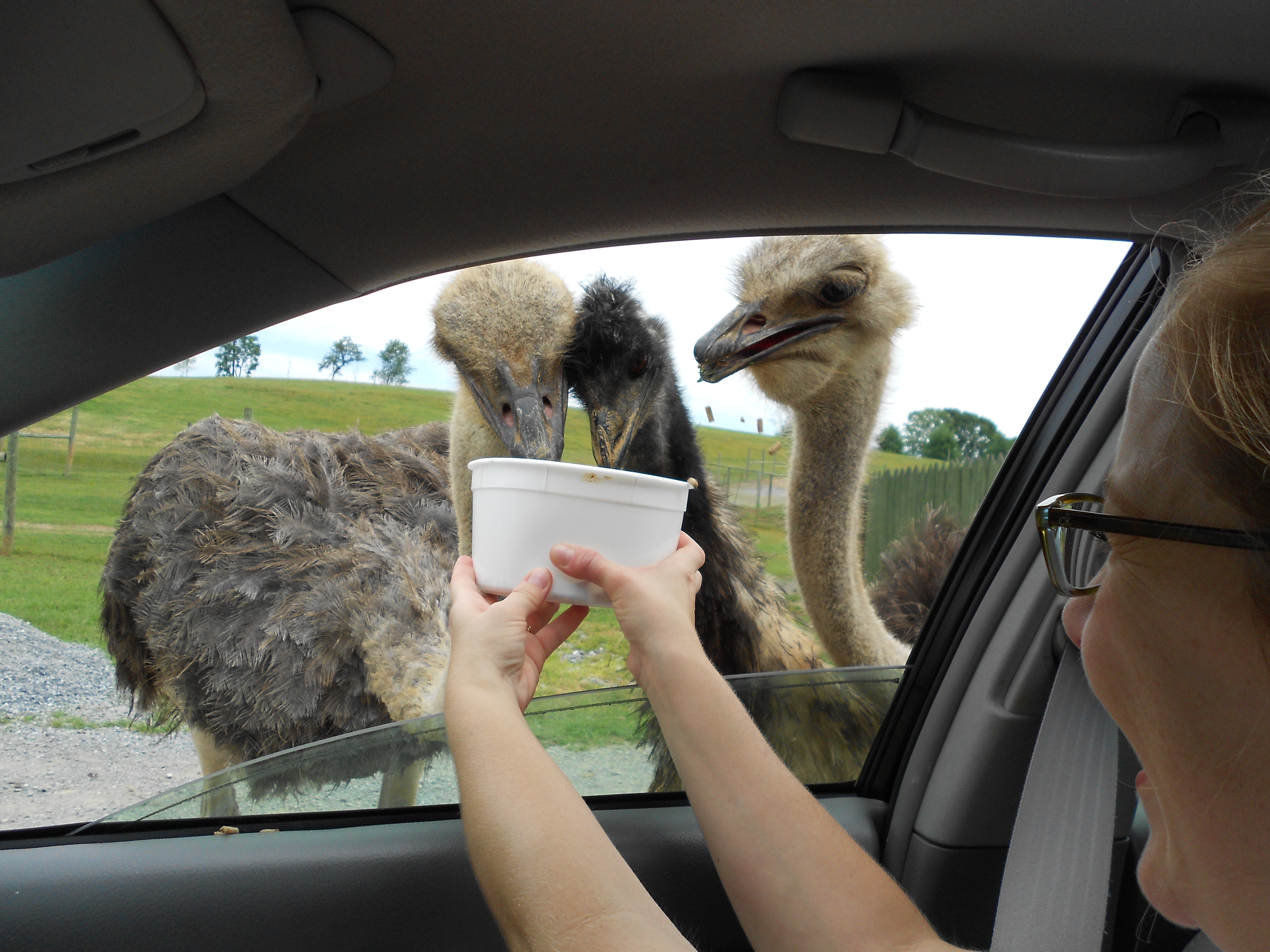
With ostrich.
Parked at the Tompkins Bend trailhead to access the Lake Ouachita Vista Trail, which winds along the southern shore of Lake Ouachita. From Tompkins Bend, I ran approximately five miles east to the Joplin trailhead, and then back to Tompkins Bend to re-fuel before heading a few miles west toward Denby Bay. 15 miles total.

View of Lake Ouachita en route to Joplin from Tompkins Bend.

